Place Standard for planning community services
Exploring the benefits of the Place Standard tool for planning community services.

The Place Standard tool can help local councils plan for community services in their local areas in several ways. It can help local councils capture perceptions of local services and identify areas of improvement with a simple framework.
It enables you to gather evidence from discussions across multiple groups and individuals, by considering the physical and social environments of a place.
How is the tool relevant?
- Provides data for use across Local Authority services and Community Planning Partnership agencies
- Ensures political engagement in a place-based approach
- Gathers qualitative baseline data (alongside demographic data/SIMD)
- Ensures priority setting
- Develops community action plans, settlement briefs and empowerment
How can the tool help resolve current issues for place-based work?
- Locality planning
- Local outcome improvement planning
- Strategic housing investment planning
Real life examples of the Place Standard tool in action
We've collected a series of case studies that showcase how local councils can use the Place Standard for planning community services. These case studies are a recollection of stories from the local councils’ point-of-view of using the Place Standard tool.
Click on the links to scroll to the selected case study.
Shetland Islands Council local development plan
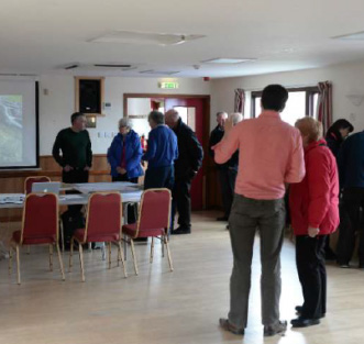
Shetland Islands Council’s community planning partners came together to use the Place Standard tool to inform their local development and locality plan.
Iain McDiarmaid, executive manager of planning reflects on the application of the Place Standard.
Image credit: Shetland Islands Council
Joint work between services who traditionally consult separately saved the council time and money and reduced ‘consultation fatigue’ for the public.
We used the Place Standard tool to facilitate:
- engagement
- corporate dialogue
- community empowerment
- decision-making
- place-based actions
The Shetland Place Standard consultation took place between 14th June - 10th July 2016. Primarily it was an online exercise. The tool was applied across all island localities. There was also some use of paper version at local venues.
The Place Standard tool was used alongside the National Standards for Community Engagement.
The survey results were analysed and presented in a final report.
Results were shared via reports to councillors, further focus meetings with community groups, published online and via press release.
Outputs provided an evidence base for main issues reporting, making places initiative and masterplanning engagement.
It influenced policy and strategy including:
- Local Outcomes Improvement Plan
- Local Development Plan
- Shetland Local Housing Strategy
- Shetland Transport Strategy
- Shetland Islands Health and Social Care Partnership: Joint Strategic Commissioning Plan
“Mindful of the need not to overburden the population with too many consultation exercises, the breadth of the Place Standard approach is especially valuable due to the range of information it produces. This makes the Place Standard directly relevant to a wide range of services across the public, private, community and voluntary sectors.”
West Dunbartonshire main issues report and local development
West Dunbartonshire aimed to embed their wider alignment approach across the council and community planning partners. Using the Place Standard tool, the council were able to engage with a wide range of ages for their main issues report and local development plans.
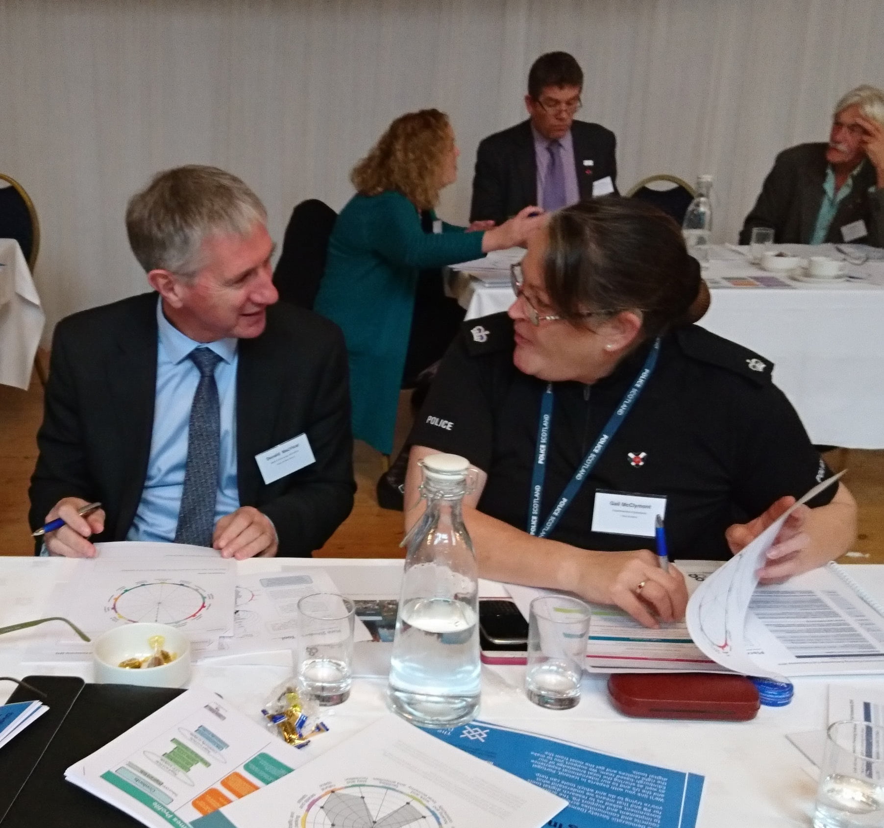
Antony McGuinness, Team Leader, forward planning reflects on using the Place Standard.
Image credit: West Dunbartonshire Council
The council has moved to basing everything we do around place.
The Local Outcome Improvement Plan (LOIP), Plan for Place, sets the direction for how we will take forward what we do around place. The ambition is to improve lives and align budgets around a place-based approach to achieve more.
The Your Place, Your Plan brand encapsulates all our plans about place.
As part of the lead practice work with the Scottish Government, we are integrating community planning and spatial planning and building capacity within our communities to plan for their own area.
We chose Place Standard as an easy-to-use tool and conversation starter. This is to help undertake a discussion around place and to collate information on what our communities thought about their place.
We built up our strategic approach in several stages.
Stage 1 - training
The Improvement Service provided Place Standard Facilitator training for our:
- Forward Planning Team
- Performance and Strategy Team
- Communities Team
- Other services within the Council and Community Planning Partners
Stage 2 - events
In the next stage we carried out several consultation events, undertaken during a 12-week consultation period.
The events helped to engage our communities in the Local Outcome Improvement Plan, Local Development Plan 2 and Locality Plans.
Events were jointly managed by our Forward Planning, Performance and Strategy, Communities and Regeneration teams and our community planning partners. At each of the seven events there were a variety of ways for people to fill out the tool. Some school children ran through it in ten minutes.
Completing the Place Standard exercise
The options to complete the Place Standard exercise during the event ranged from:
- simple sheets for people to complete using the Place Standard diagram, asking for three top priorities
- Place Standard questions that think about points pinned on the wall for people to complete themselves if they had slightly longer
- full facilitated sessions with groups which were usually undertaken in one hour
Postcode data was also recorded to allow for place-based analysis of responses.
Outputs were converted into a database which was jointly used for the Local Outcome Improvement Plan, Local Development Plan 2 and Locality Plans.
The work has been endorsed by the Local Authority Chief Executive, Strategic Director and Council Leader and Community planning partners. The Community Planning West Dunbartonshire Management board oversee the integration of community and spatial planning.
Informing services, plans and strategies
The intention is to distribute the findings of the consultation events to the various departments within the council. We intend to use the information to inform the delivery of services and the wider formulation of plans and strategies.
It is informing the Local Outcome Improvement Plan and Locality Plans, as well as LDP 2. We’re intending that Locality Plans will become part of the proposed plan as supplementary guidance.
These may be combined with local place plans to keep a place focus and to help link to resources supporting communities to implement place plans.
Clydebank Waterfront locality plan
This process is already starting with work on a Clydebank Waterfront locality plan, supported by Scottish Government. It will be informed by a pilot project we are undertaking which is part funded by the Scottish Government under their Making Places initiative.
This will include specific actions to improve wellbeing, tackle inequality and disadvantage, focused on a small geographic area around the Forth and Clyde Canal and Clydebank town centre.
Further targeted consultation is planned with community councils and other community groups. Participatory Budgeting work is also intended using the place focus to target resources.
“The use of the Place Standard within the Your Place, Your Plan consultation resulted in substantially more people being engaged in the Main Issues Report, Local Outcome Improvement Plan and Locality Plan and providing comments on those documents. Specifically, over 100 people were engaged in the Main Issues Report with the same number or more being involved in completing the place standard. This was an early success for the alignment of the plans and teams.”
Case study: Planning at a local authority scale
Download this case study for further lessons learned from Shetland Islands Council and West Dunbartonshire.
(Published in July 2018)
Argyll and Bute local development plan and locality plan consultation
Argyll and Bute Council brought together a wide range of participants for the Place Standard exercise. Used to survey ‘how the community felt about its place’, the survey helped the council to facilitate conversations about place.
In this case study we compare two perspectives on the use of the Place Standard: Community Planning Officer, Samantha Somers, and Spatial Planning Officer, Sybil Johnson.
Image credit: Argyll and Bute Council
Community Planning Officer’s view
The tool was used to survey ‘how a community felt about its place’. The process was intended to facilitate place-based actions as required in national policy.
The Place Standard tool was a cross-service engagement tool that provided evidence to inform locality planning. We built our own version of the tool on the council website for us to collate all the responses centrally.
Delivering assessments
The assessments were mainly completed by individuals. However, we were able to piggy-back onto CPR training, delivered by the Scottish Fire and Rescue Service where there were larger groups present.
Identifying areas for action
The Community Planning Outcome Profile tool from Improvement Service was used in conjunction with the Place Standard tool when analysing the results and identifying priority areas for action.
Mapping results
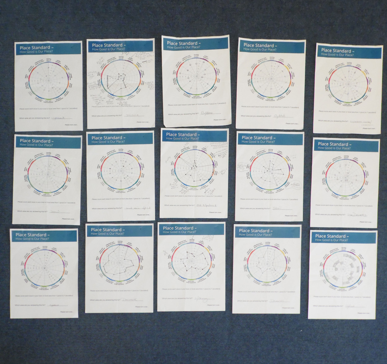
Data was collated and averaged to create compass diagrams, presented in a report. There was a compass diagram produced for each postcode area, island and administrative area. Scores of three or less were focused on as weaknesses requiring action.
We went back to local Area Community Planning groups to establish actions at a local level and then verified these with the Community Planning Partnership (CPP) management committee. One-year community action plans have been produced for each area and are public documents which are available freely. The findings from the tool were used to focus actions on community planning locality plans.
Verifying improvement implementations
Higher scores were common for Natural Space and Feeling Safe with lower scores for Public Transport, Moving Around and Work/Local Economy. We intend to use the tool again every two or three years, linked to locality plan timescales to test the effect of implementing improvements.
Serving a wide range of agencies and services
The data gathered is being widely used by partner agencies including:
- Police Scotland
- Highlands and Islands Enterprise
- Scottish Fire and Rescue
- community groups
- community councils
- private sector
- Health and Social Care Partnerships
- NHS Highland
- third sector
- social enterprise
Within Argyll and Bute Council it’s being used by a range of services:
- Children and Families
- Housing
- Roads and Transport
- Economic Development
- Planning
- Education
“We targeted anyone and everyone who was a resident of Argyll and Bute to get the fullest response possible - we didn’t focus or specify any particular demographics. However, when doing face-to-face events, we did try and target those who maybe aren’t as likely to complete an online consultation.”
Spatial Planning Officer’s view
The tool was used to facilitate engagement, corporate dialogue, community empowerment, decision-making and Place-Based actions. In particular:
- Used to start the conversation on the Local Development Plan process
- Opportunity for joint working and aligning agendas within the council
- Recommended by the Scottish Government in the SPP
- Simple tool that is easily applied
Our web team adapted the Place Standard tool, running it online and collating the results.
We ran an equalities assessment form alongside the tool. People could comment on a town, village or location. We also used Geographic Information System (GIS) to aggregate the results to different geographies for different purposes.
Local development plan pre-engagement activities
In terms of the LDP pre-engagement we had:
- stakeholder meetings
- community council events
- councillor workshops
- assessment of monitoring data
- Call for Sites - information from developers
- Call for Ideas - more in-depth information asked for by survey that built on the PST from community stakeholders and the public
Data was presented in spreadsheets and analysed via pie charts. The output report was shared on the council portal.
Influencing a wide range of plans
In terms of the Local Development Plan, we used the information in the Monitoring Statement that accompanied the Main Issues Report (MIR) consultation. It was part of the background evidence that helped us write the MIR.
The Place Standard had influence on Local Development Plan, Economic Development Action Plan, Argyll and Bute Outcome Improvement Plan.
Results for Rothesay, Helensburgh and Oban
One example from the Monitoring Statement: ‘Participants in Rothesay had the lowest score in respect of work and the local economy whereas Helensburgh and Oban participants scored this higher.’
The Main Issues Report then proposed the retainment of Rothesay as a regeneration area, and Helensburgh and the wider Oban, designated as growth areas due to its potential. This was based on a range of evidence including the Place Standard tool results.
The next stage of use is anticipated in five years in run-up to next LDP.
“It was very useful to run this exercise in conjunction with our colleagues in Economic Development and Community Planning. This ensured we are working off a common data set and meant we could jointly apply more resource to the process thereby improving the response level.”
Case study: Planning at local authority scale for Argyll and Bute
Download this case study for further lessons learned from Argyll and Bute Council.
(Published in June 2016)
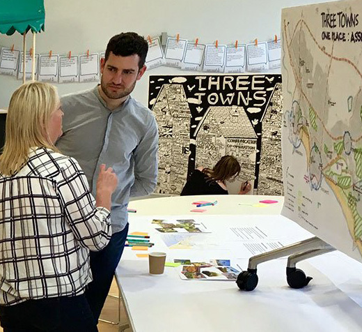
North Ayrshire three towns locality plan and charette
The initiative in North Ayrshire was part of an award-winning programme of engagement—developed with the Consultation Institution—to co-produce Locality Partnerships and their priorities and action plans.
Rhona Arthur, Senior Manager (Information & Culture) and James McHarg, Senior Manager (Participation and Empowerment) of North Ayrshire Council reflect on using the Place Standard tool.
Image credit: North Ayrshire Council
We used the Place Standard to compile data on local perceptions, alongside other forms of data gathering. The structure of the tool fitted with our need to assess local issues that linked to national strategic plans.
It was a fun activity that engaged people in needs assessment without being too difficult to understand.
The tool captures perception data well and is lively and inclusive. It captured range of issues we were already considering and has a useful IT interface to produce the spider diagram.
This in turn informed the priority-setting and action plans of Locality Partnerships.
By collating the individual comments, we arrived at the aggregated view of how the participants viewed their community. The perception data gathered sits well with Community Planning Partnership (CPP) data sets, so this was very much a blended approach.
Priority setting workshop events
We began with priority-setting workshop events advertised via social media, the CPP website, newspapers, libraries, digital signage and word of mouth.
The National Standards for Community Engagement were used in conjunction with the tool and our Community Learning and Development Team were all involved in planning the event.
We held events using the tool for six separate localities across North Ayrshire. The first step involved a rapid appraisal of a locality or a neighbourhood by local community participants, producing compass diagrams with the on-line tool.
Capturing conversations through posters
For each event we created our own large-scale ‘bullseye’ posters and a talking wall to capture dialogue from groups as they moved around the room.
We simplified scoring by asking the community participants to allocate sticky dots to their priorities on the ‘bullseye’ poster. The closer to the bullseye, the higher the priority and the closer to the outer ring the lower the priority.
It was a rapid assessment looking at the locality and focused on commonalities, with differences taken out as issues for a talking wall (e.g. car parking was an issue in Largs but not in Skelmorlie, so it was added to the talking wall for a follow-up discussion).
Group assessments
We then undertook a group-based assessment of the Place Standard results in relation to:
- the outcomes of the Health & Social Care Partnership priorities
- findings within the Areas of Family Resilience profiles
- Scottish Index of Multiple Deprivation (SIMD) data
- Local Development Plan 2 (LDP2) data - for example Housing Land Supply or digital infrastructure
Identifying priorities and needs
In this way, we used the outcome of the Place Standard to test and challenge perceived community need against ‘real’ need identified through statistical analysis. We then identified the local priorities to be addressed (linked to SIMD data and Health & Social Care Partnership priorities).
Following the triangulation of the findings against other plans and statistics, the Locality Planning Partnerships felt they had a good basis for making decisions on how to address key local needs.
We collated all the target data and used the online tool to present visual spider diagrams for feedback.
The process has helped to catalyse the work of a range of local groups who are collaborating on spatial development and community regeneration.
Priority setting
We issued the data to the Locality Partnership members and made a presentation of findings, prior to discussion to agree the final priorities for approval.
Councillors in some areas challenged the outcome, but after reflection, agreed that the findings were by and large reflective of local opinion. The spider diagrams are all publicly available on the Locality Partnership’s website.
Exploring action plans and priority setting
Further meetings and events were held to develop the learning and explore action planning and priority setting.
This was within the planned Locality Planning Partnerships, which led to a sequential development of Locality Plans. These are being delivered through local partnerships with the assistance of the North Ayrshire Council’s £3.164 million Community Investment Fund and external funding.
Design charette
The output also supported spatial planning and informed briefing for a design charrette in the Three Towns. This was concluded in early January 2018, with its findings embedded in the Three Towns’ Locality Plan.
The outputs assisted LDP2 preparation, with each of the Locality Partnership’s priorities forming an integral part.
Funding support and future use of the Place Standard
We have made good progress to date and are lucky to have the support of some council investment funding to begin linking right through from the Place Standard outcomes to funded initiatives.
We plan to revisit the process regularly, using the Place Standard as a baseline against which we can measure progress in future.
Some communities are carrying out their own Place Standard reviews. For example, Irvine completed a review in 2018 and added ’Sense of Influence and Control’ to their Locality priorities as a result.
“The sheer energy and level of debate exceeded expectations. We created our own large-scale charts and a talking wall to capture the dialogue and then used the online tool to provide visual spider diagram for feedback.”
Case study: Planning at settlement scale for North Ayrshire
Download this case study for further lessons learned from North Ayrshire Council.
(Published in June 2019)
Planning community services made easy
Plan the community service of your local area with the Place Standard tool. If you’re in the process or are considering the tool for your local needs, we can help you get started. From learning resources to workshops, let us guide you in the right direction to help plan for better places.